
Lake Winnipeg Facts
- Lake Winnipeg is the 10th largest freshwater lake in the world
- Lake Winnipeg is the 6th largest lake in Canada
- Lake Winnipeg crosses four Canadian provinces and 4 US states
- Lake Winnipeg drainage basin is nearly 1,000,000km2
- Lake Winnipeg basin is home to 7 million people
- Only one river flows out of Lake Winnipeg – the Nelson River
- Lake Winnipeg is the last remnant of glacial Lake Agassiz
- Lake Winnipeg surface area is 23,750km2
- Lake Winnipeg is 111km wide at its widest point
- Lake Winnipeg maximum depth is 36 m
- Lake Winnipeg average depth is 12m
- Lake Winnipeg shoreline is 1750km long
- Lake Winnipeg shoreline is 284km3
- Lake Winnipeg climate is cold continental
- Lake Winnipeg is the 3rd largest hydro-electric reservoir in the world (hydro-electric began in 1976)
- There are between 180-195 open water days on Lake Winnipeg
- Mean annual precipitation in Lake Winnipeg Watershed is 400-600mm
- Snowfall represents 15-20% of total precipitation in Southern Basin
- Snowfall represents 30-40% of total precipitation in Northern Basin
- The average water residence time is 4.3 years for the whole of Lake Winnipeg; 1.3 years for the South Basin and 3.5 years for the North Basin
- Of the 3 major rivers flowing into Lake Winnipeg, the Winnipeg river contributes 50% of the water, the Saskatchewan 25%, and the Red and Assiniboine 16%
- 60% of the phosphorus coming in is retained by Lake Winnipeg; 54% of N
- The Red River is the largest source of total P and N, and the N and P export per hectare is highest in the Red River
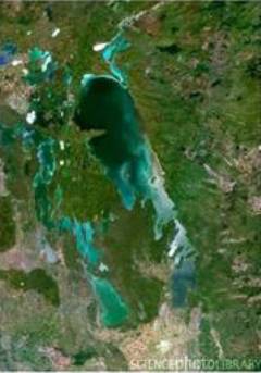
- Lake Winnipeg has the highest chlorophyll concentrations of any of the largest lakes in the world