|
|
|
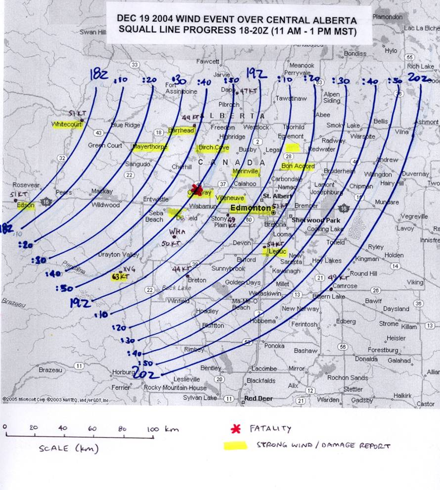
| LOCALITY | TIME | DAMAGE REPORT |
|---|---|---|
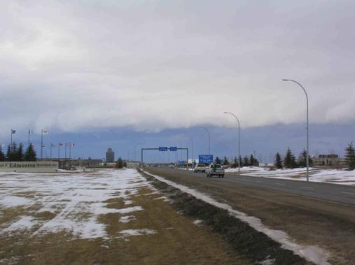
| Mayerthorpe (120 km NW Edmonton) | 11:18 am | Radio tower bent in half, shingles blown off roofs, flying debris, power outages |
| Alberta Beach (Lac Ste. Anne) (60 km W of Edmonton) | 11:50 am (est) | ** FATALITY ** - kiteboarder on Lac Ste. Anne blown into church building by strong winds |
| Onoway (60 km NW Edmonton) | 11:50 am (est) | 160 ft X 40 ft hay shed destroyed by strong winds, forty 6 x 6 supports broken |
| Villeneuve (10 km NW Edmonton) | 12:05 pm (est) | Small planes flipped over at Villeneuve airport |
| Morinville (20 km N Edmonton) | 12:10 pm (est) | Flat metal roof ripped off maintenance shed, shingles off, other damage in area |
| Fedorah (40 km N Edmonton) | 12:10 pm (est) | Roof pieces flying off, tree limbs falling |
| Edmonton | 12:15 pm (est) | 112 glass panels at City Hall damaged by flying gravel from nearby rooftops; $250K damage |
| Millet(40 km S Edmonton) | 12:40 pm (est) | Unoccupied mobile home flipped over |
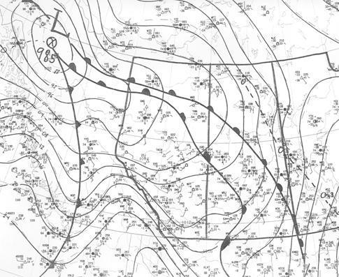 |
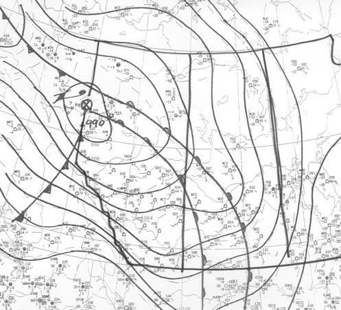
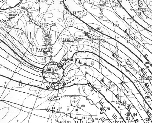
12z surface analysis, Dec 19 2004 985 mb low pressure centre over northern BC with warm front extending into southwestern Saskatchewan and maritime cold front slicing southward into southern BC. It is along this cold front that the convectively-induced wind event would develop. Deeper arctic air is found east and north of arctic frontal boundary to the east of maritime warm front. An extensive area of snow is occurring east of arctic warm front with band of freezing rain immediately along warm front over Saskatchewan. Very mild airmass over most of Alberta with 12z temperatures above freezing over most places. Edmonton is +3°C while Calgary is +10°C with a brisk westerly chinook |
 |
15z surface analysis, Dec 19 2004 The cold front associated with this event started moving across the BC-Alberta border around 1500z (8 am MST). Temperatures ahead of the front in the maritime warm sector were in the +7 to +10°C range with dewpoints around -1°C. Behind the front, temperatures fell quite sharply with rain showers changing to snow. An observation from Grande Cache (elevation 1200m, just inside the Alberta border) at 1624Z indicated zero visibility in heavy snow and blowing snow, west winds of 40-45 knots and a temperature drop from +11°C to 0°C in an hour and a half. |
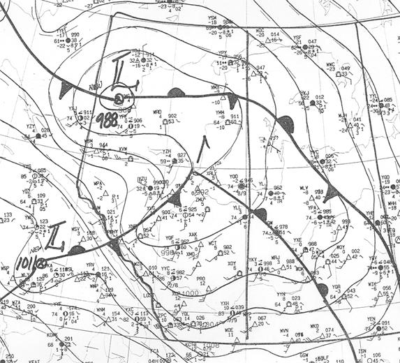 |
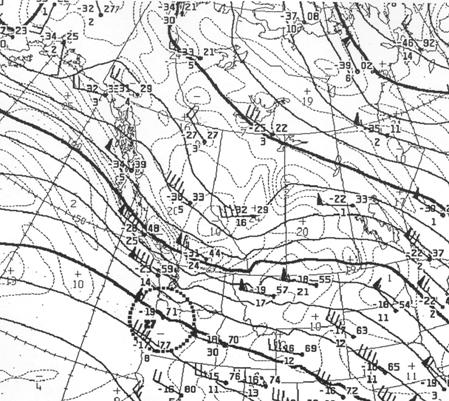
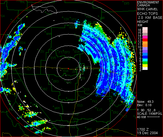
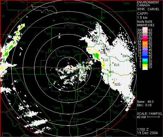
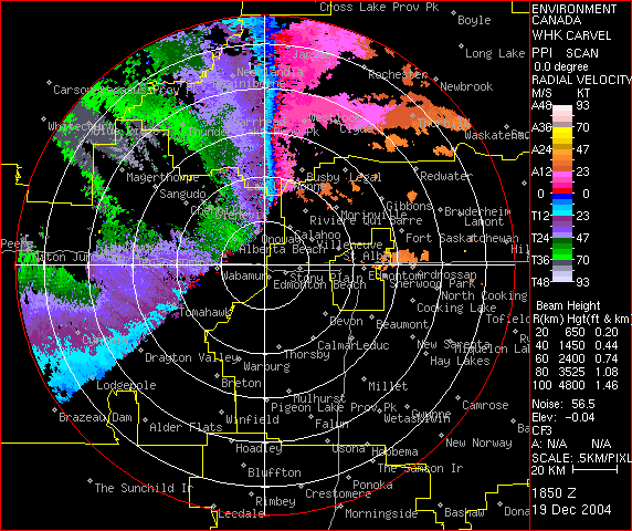
18z surface analysis, Dec 19 2004 At 1800Z, the main low was analysed over northwestern Alberta northwest of Peace River with a central pressure of 988 mb. A maritime wave was now analysed near Slave Lake southeast of the main low as the warm air was beginning to occlude out of the system. The associated maritime cold front was extending southwestward over west-central Alberta having just moved through Edson and Whitecourt at 1750Z with peak wind gusts of 51 kt (95 km/h) from the northwest at both locations. The front was also accompanied by a mixture of rain, snow and ice pellets with Whitecourt reporting thunder and lightning at 1800Z. Temperatures drop behind the maritime front but still remain near or above freezing. Colder arctic air is found north of the arctic cold front pushing through northern BC. |
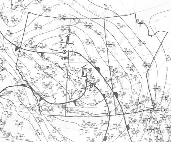 |
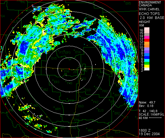
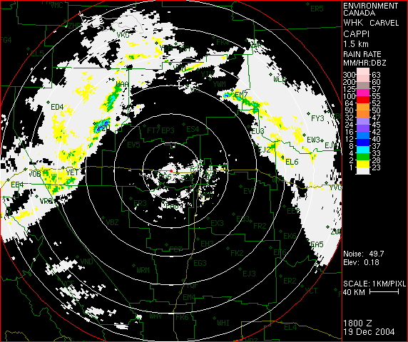
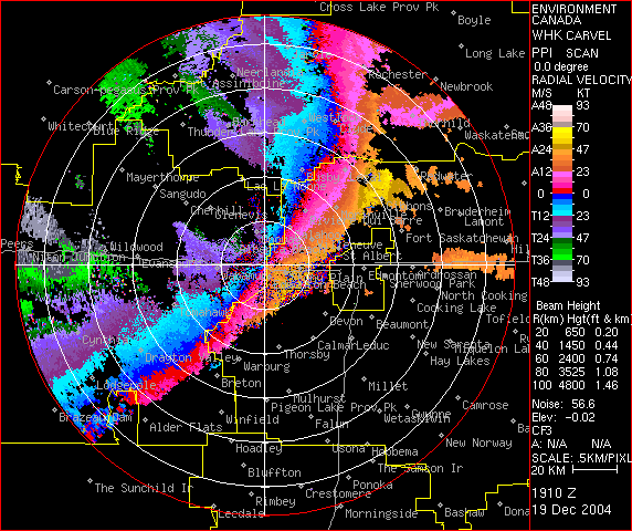
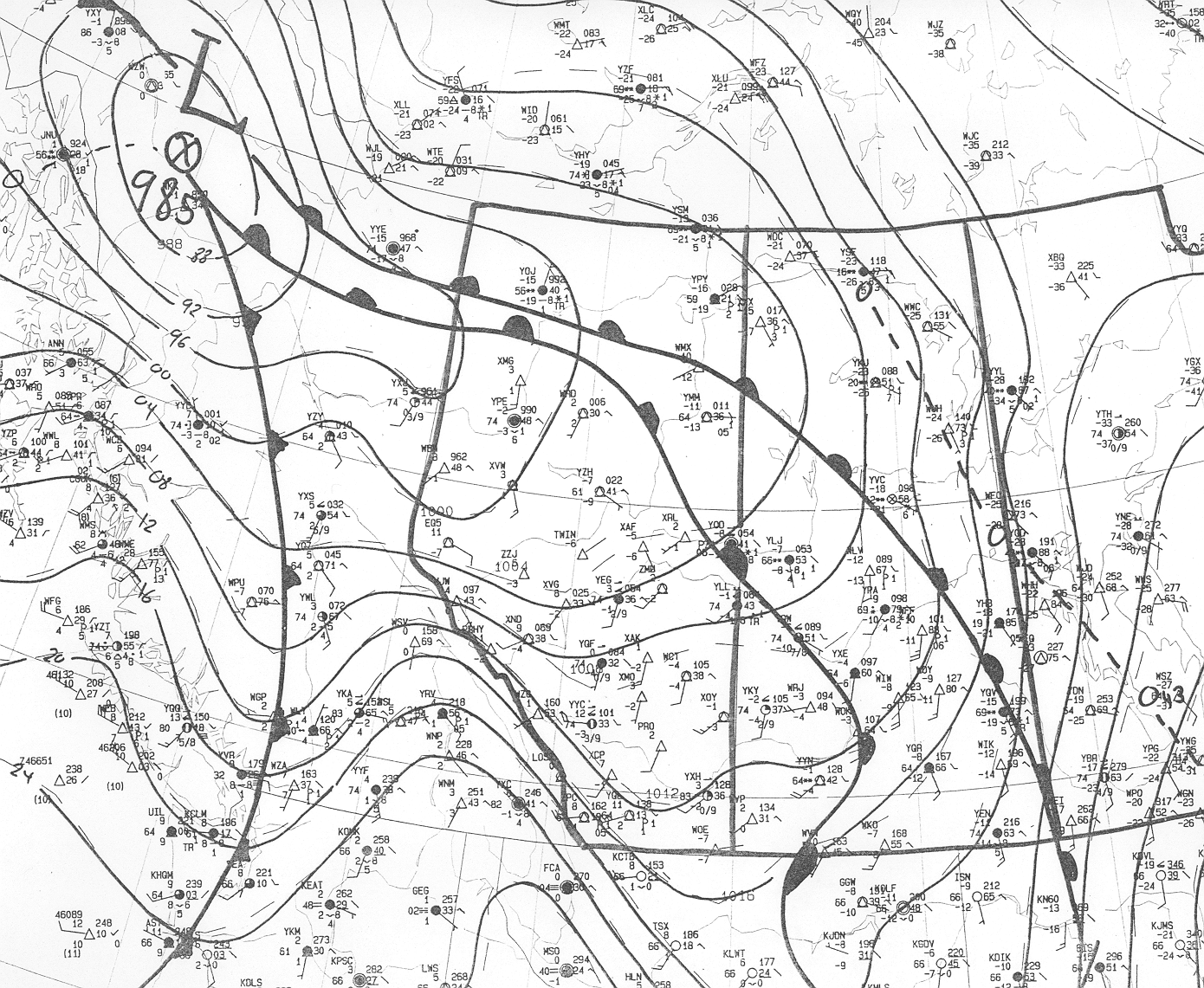
00Z surface analysis, Dec 20 2004 By 0000Z the main surface low had moved across northern Alberta into the Fort McMurray area with a central pressure of 986 mb. Southeast of the main low was a maritime wave centred near Saskatoon with an associated cold front over southwestern SK into southern AB. This front was still producing wind gusts to 90 km/h with wind warnings still in effect at 00Z associated with the frontal passage. This front marked the leading edge of cooler air over Alberta but the deeper arctic air was still confined to the far north behind the arctic cold front which was moving through the Peace River area behind the main low at 00Z. |
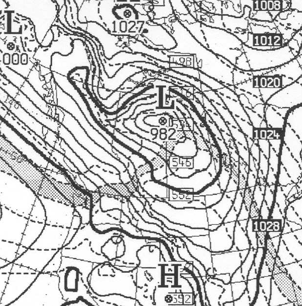 |
12 hr surface prog Valid 00Z (6 pm MST) Dec 20 2004
12 hour surface prog from CMC's regional model shows 982 mb low over Fort McMurray area with maritime wave over central SK. 1000-500 mb thickness pattern suggests maritime cold front over southern Alberta with cooling aloft noted behind front. � Arctic cold front lays farther north over northern Alberta extending westward from main surface low. This front marks the leading edge of the true arctic airmass. Prog has done quite well with positions of maritime and arctic features although main low over northeastern AB is 4 mb too deep. |
| 
|
| 12Z 500 mb analysis | 00Z 500 mb analysis |
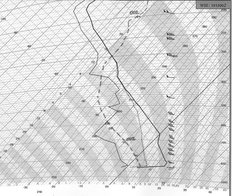 |
12Z Stony Plain (WSE) sounding
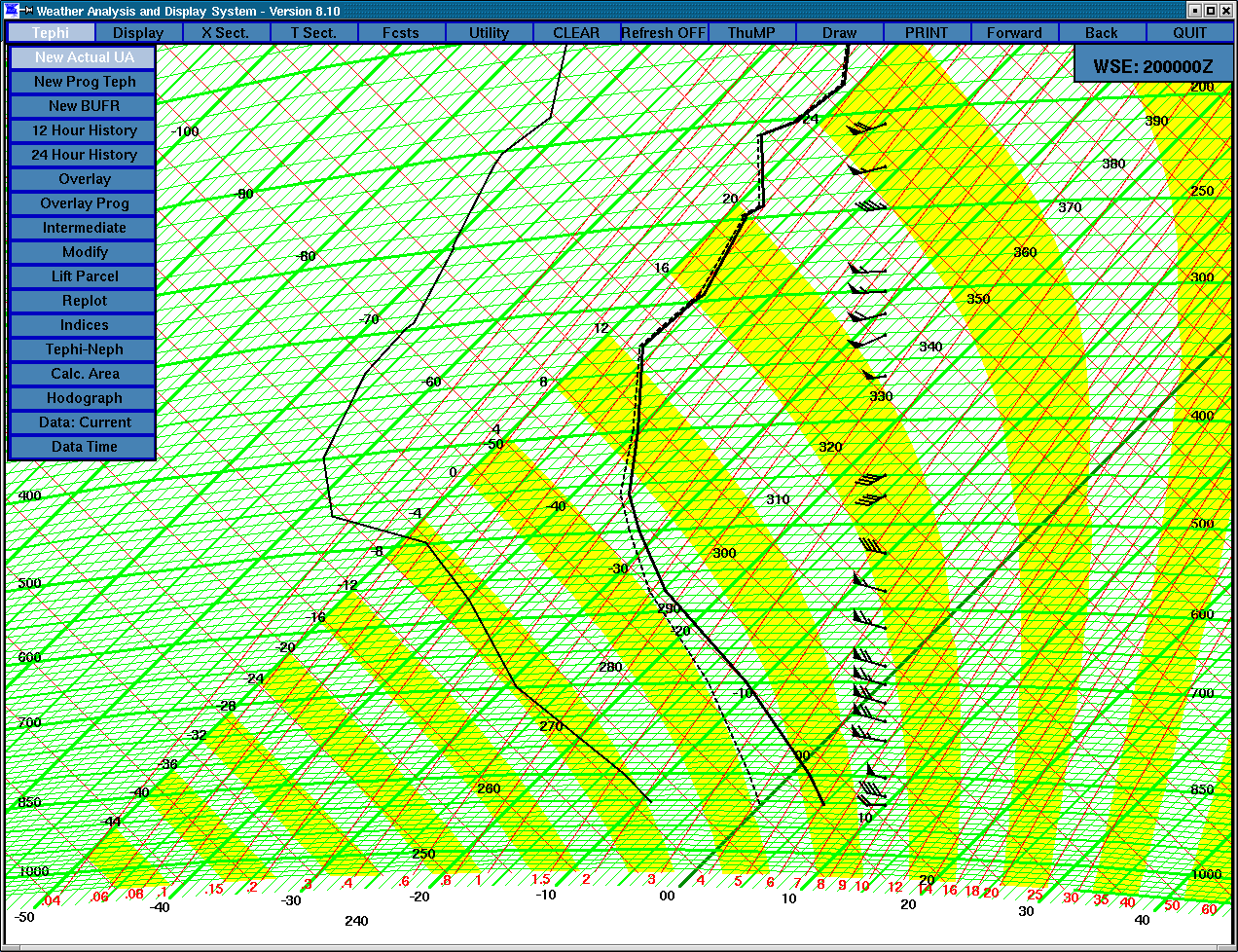
12Z sounding from Stony Plain shows unseasonably warm airmass over central Alberta with +14°C temperatures at 900 mb and a freezing level above 700 mb (10,000 ft). Edmonton would set a record high of +8°C by noon before the maritime cold front sent temperatures lower in the afternoon. Dramatic cooling of airmass noted by dashed line showing dry bulb temperatures 12 hours later at 00Z. 850 mb temperatures drop from +12°C to -5°C while 500 mb temperatures drop from -18°C to -32°C in 12 hours. (00Z WSE sounding) |
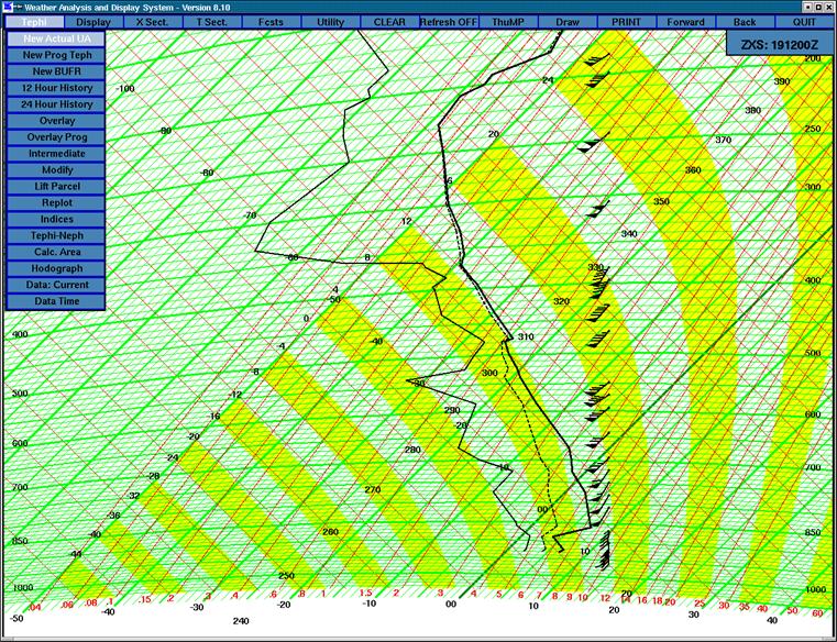 |
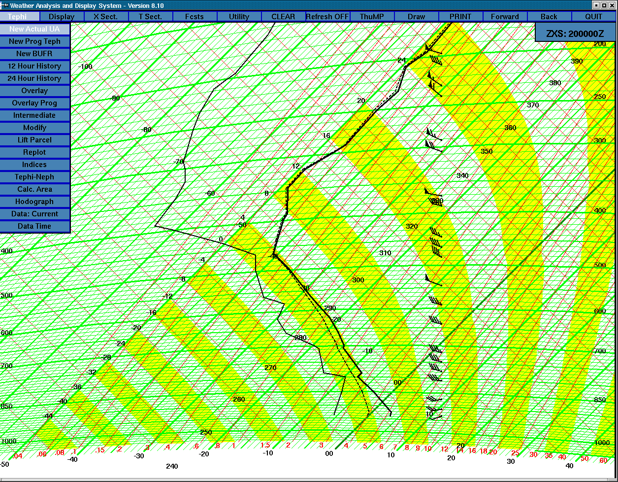
12Z Prince George (YXS) sounding)
This sounding represents the airmass just ahead of the maritime cold front as it was moving across interior BC at 12Z. Warm air at 850 mb would have prevented any surface-based instability along front. However, sounding shows potential instability above 700 mb given enough lift and moisture advection at this level. Colder air moving in aloft from the west would produce even steeper lapse rates and instability from this sounding. (see 00Z YXS sounding) Note very strong winds throughout column with 50+ knot winds from 800 mb and above with 70-80 knot winds from 700 to 500 mb. |
 |
 |
 |
 |
 |
 |
 |
 |
|
|
 |
 |
 |
 |
 |
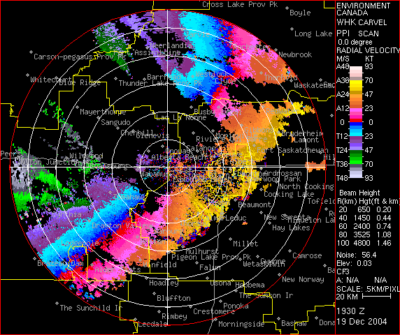 |
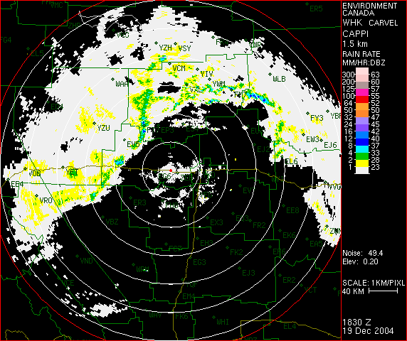
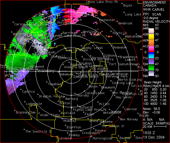
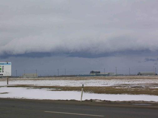
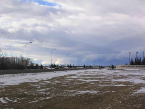
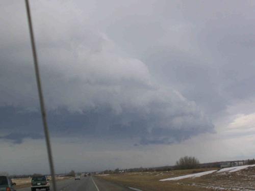
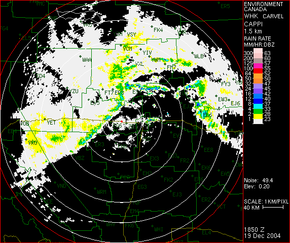
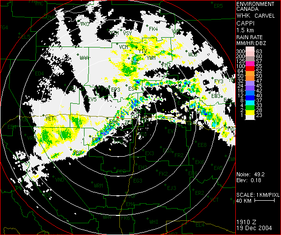
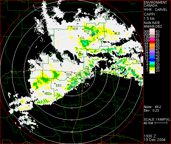
SPECIAL WEATHER STATEMENT ISSUED FOR..
SPRUCE-GROVE-MORINVILLE-MAYERTHORPE-EVANSBURG
WESTLOCK-BARRHEAD-ATHABASCA
WHITECOURT-EDSON-FOX CREEK-SWAN HILLS.

..LINE OF SHOWERS AND LOCAL THUNDERSTORMS PRODUCING STRONG WINDS..

A LINE OF SHOWERS AND RARE DECEMBER THUNDERSTORMS HAS DEVELOPED OVER WEST
CENTRAL ALBERTA FROM EDSON TO WHITECOURT. THE LINE HAS PRODUCED WIND GUSTS
TO 70 TO 80 KM/H ALONG WITH SMALL HAIL AND REDUCED VISIBILITIES IN RAIN AND
SNOW. THIS LINE IS MOVING EAST AT 70 KM/H AND WILL AFFECT AREAS FROM EVANSBURG
TO BARRHEAD AND AREAS EAST OVER THE NEXT HOUR.