
Red River Flood Extent Measured by RADARSAT
as of 1 May 1997, 7:32 am
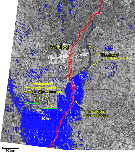
© Canadian Space Agency, 1997
Data Received by: Canada Centre for Remote Sensing
Processed and distributed by: RADARSAT International Inc.
Interpreted by: Vantage Point International & CCT / CCRS