|
| Background | Research | Bibliography | TEWG | Events | Links | Google Earth |
Landscape Dynamics Laboratory
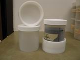
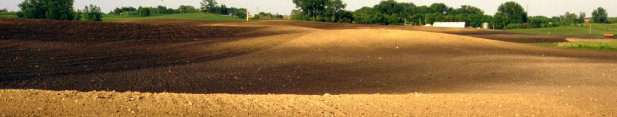
In 2000, Lobb received funding ($554,000) from the Canadian Foundation for Innovation (CFI) under the New Opportunities program, the Manitoba Innovation Fund, industry (Canberra Ltd., Trimble Navigation Ltd.), and the University of Manitoba (UofM) to support his research on soil erosion. About one half of these funds ($281,500) were used to develop the Landscape Dynamics Laboratories (LDL) (www.umanitoba.ca/outreach/tillage_erosion/LDL.htm). Additional funds ($65,600) were also received in 2000 from the Natural Sciences and Engineering Research Council (NSERC) under the Equipment Grants program to further develop the laboratories. In 2004, the LDL was expanded with the acquisition of equipment ($300,000) from Fisheries and Oceans Canada. The laboratories are located in the Ellis Building on the Fort Garry Campus of the UofM and is operated by the Department of Soil Science. The LDL is directed by Lobb, managed part-time by a post doctoral fellow, Sheng Li, and employs a full-time technician, Eva Slavicek and a part-time Research Associate, Paul Wilkinson. The major component of the Landscape Dynamics Laboratories is the Environmental Radiochemistry Laboratory (ERL). The ERL is equipped with seven gamma spectrometers and sixteen alpha spectrometers for the analysis of soil and sediment for 137Cs and 210Pb. Two gamma specs are equipped with Broad Energy Germanium (BEGe) detectors which are set up to analyse 137Cs on both medium (200–400 g) and large (500–1000 g) samples. Five gamma specs are equipped with coaxial GE (P-type) detectors which are set up to analyse 137Cs on small (10–20 g) and medium samples. The alpha spectrometers are used to analyze for 210Pb. Medium and large soil samples are normally used when generating inventories (surface patterns, measured in Bq m-2) of 137Cs and 210Pb to assess the patterns and rates of soil redistribution within fields. From these patterns, soil erosion processes (wind, water and tillage erosion) are discriminated by their spatial signatures. Small samples of soil or sediment are normally used when generating profiles (vertical sections, measured in Bq kg-1) of 137Cs and 210Pb to assess the rates of accumulation in concave areas of fields or sedimentation in waterbodies of watersheds. Lobb receives funding for his participation as the Chief Scientific Investigator
for Canada in the International Atomic Energy Agency (IAEA) Co-ordinated
Research Project: Use of fallout radionuclides to evaluate the effectiveness
of soil conservation measures for sustainable crop production (2003-2008).
As a consequence of this participation, the Landscape Dynamics Laboratory
was invited to participate in the IAEA Co-ordinated Research Project:
Proficiency test for the determination of 137Cs and 210Pb in soil (IAEA
CRP DI.50.08, 2005-2006), and was successful in attaining “Acceptable”
levels of proficiency (trueness and precision). The laboratory has also
participated in the IAEA Co-ordinated Research Project: Proficiency test
/ comparison on the determination of gamma-emitting radionuclides in soil,
grass and water (IAEA CU-2006-03, 2006-2007), and was successful in attaining
“Acceptable” levels of proficiency. The laboratory also served
as host to two IAEA Visiting Fellows in 2006. |
|
Tillage Translocatiom and Tillage Erosion is a subsite of the Soil Science Dept , University of Manitoba
|