Remapping & Rewriting Public Space: Decolonizing Winnipeg’s Landscape Through Storied Design
Instructor: Honoure Black
EVDS 3710 T69 & ARCG 7070 T34
Monday/Wednesday | 6:00 pm - 8:45 pm
July 1 - August 9
3 credit hours
The University of Manitoba campuses and research spaces are located on original lands of Anishinaabeg, Ininiwak, Anisininewuk, Dakota Oyate, Dene and Inuit, and on the National Homeland of the Red River Métis. More
University of Manitoba
Winnipeg, Manitoba Canada, R3T 2N2
Below is a list of Faculty of Architecture Courses that will be open for registration starting April 8, 2024.
The Faculty of Architecture at the University of Manitoba will be offering the following online distant education 1000 level Environmental Design courses during 2024 Summer Term.
If you have any questions about these courses or the Environmental Design Program please email env.design@umanitoba.ca
Instructor: Honoure Black
EVDS 3710 T69 & ARCG 7070 T34
Monday/Wednesday | 6:00 pm - 8:45 pm
July 1 - August 9
3 credit hours
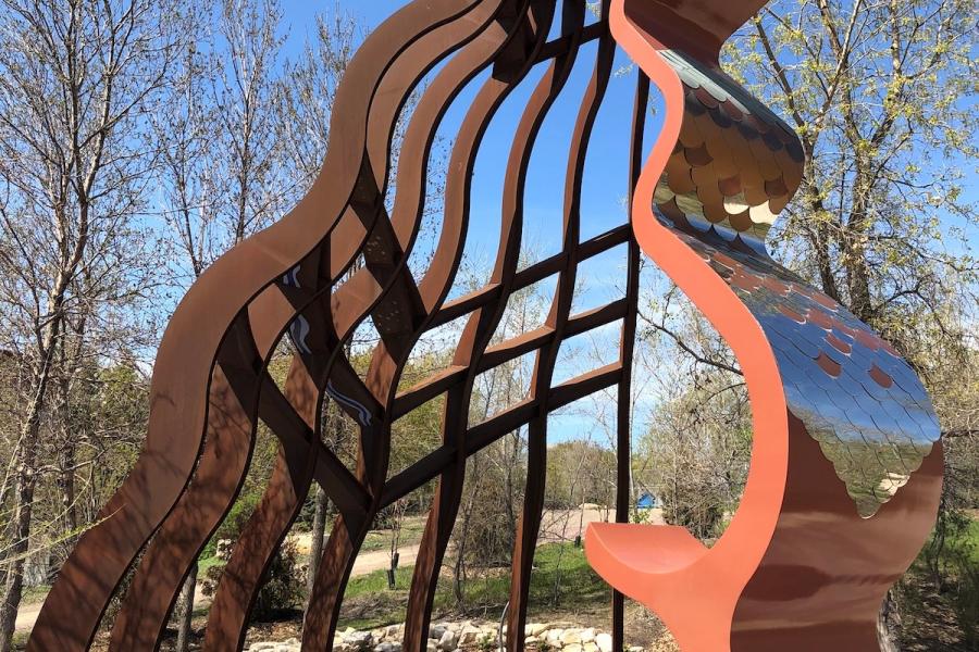
This course investigates contemporary decolonial urban placemaking in Winnipeg, Treaty One. Decolonial public space is often defined as reimagined spaces and places that seek to diversify or counter the settler colonial gaze. In addition, I like to think of decolonial placemaking as an opportunity to rewrite or remap the landscape through interdisciplinary art and design initiatives that often incorporate storytelling. During this course I will ask: how can we, as an interdisciplinary cohort, work together to unsettle the future of our public spaces and places? How does the interdisciplinary nature of public design work to benefit a place? What would you like to see incorporated into our city?
Topics and themes covered in this course relate to specific sites concerning reconciliation, Indigenous resurgence, Queerness, Black Lives Matter activism, BIPOC initiatives, and spaces for those with disabilities. As a class we will explore the following sites: The Forks, The Rapid Transit Line (blue line), This Place (Air Canada Park), Assiniboine Park, certain locations in North Point Douglas, the U of M Campus, and more. Students will embark on several field trips and hear from a variety of guest speakers who have participated in decolonizing public space in their field. These will include, but are not limited to planners, architects, landscape architects, designers, artists, profit and non-for-profit collaborators and funders (such as the Winnipeg Arts Council). Each of these participants have worked to counter whiteness, heteropatriarchy, and settler colonialism (to name a few).
This course will provide students an opportunity to engage and analyze site-specific locations in our city, hear from active collaborators, and participate in weekly reading seminar discussions regarding the most up-to-date publications and design initiatives. In the second half of the course students will apply the knowledge gained from their readings, seminar discussions, and field trips to create their own decolonial site design. Each student or group of students will be assigned a particular site, and their work will be exhibited in an exhibition in the Architecture 2 gallery.
Instructor: Ainsley Johnston
EVDS 3710
Tuesday/Thursday | 9:00 am - 11:45 am
May 6 - June 13
3 credit hours
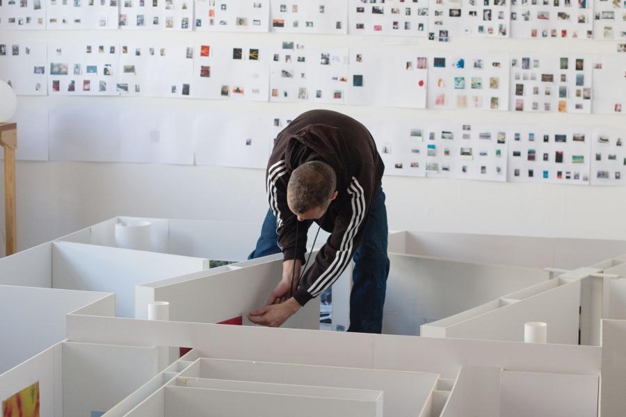
The seminar situates the Architecture 2 Gallery as a laboratory to collect, assemble and broadcast ideas on timely issues in design and planning. Students take on the multipronged role of researcher, editor, designer, curator, coordinator and storyteller, using the gallery space as a site for critical thinking and experimental practice. The seminar will involve inputs from external guests specializing in exhibitions and publications from Basel, Berlin, Montreal and Winnipeg, and the group will visit and study museum-like environments across the city and province.
Students will develop fully-fledged exhibition proposals, using a spatial sensibility to research contemporary topics of interest, extract possible narratives for the public to engage with, and prototype methods of display.
Instructor: Dietmar Straub
ARCG 7102
Monday - Friday | 9:00 am - 4:00 pm
May 1 - May 31
6 credit hours
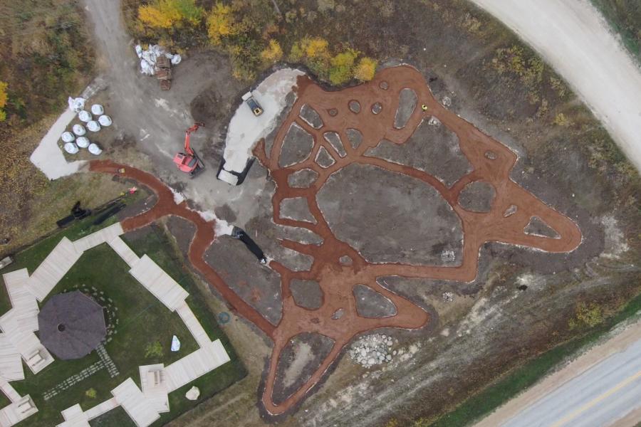
Since 2018, Lake Manitoba’s Health Centre members have been working collaboratively with Anna Thurmayr and Dietmar Straub from the Department of Landscape Architecture at the University of Manitoba and the College of Rehabilitation Sciences to develop healthy and accessible outdoor environments on and adjacent to their Health Centre grounds. The intention of the project is to develop a ‘walking path’ for the elders of this community to support aging in place. In concert with the Zaagaate Garden (realized in 2018), the Shared Path will become the new ‘Green Heart’ within the community. The trail landscape will turn the site into a gathering place where young and old can meet, share, and create new stories.
The Ligneous Artefacts studio is part of the Shared Path initiative that will advance the University of Manitoba’s relationship with the Lake Manitoba First Nation. It engages community members of all ages and abilities and university students from multiple faculties (Faculty of Architecture and Rady Faculty of Health Sciences) to participate in hands-on workshops and design-build studios to develop and maximize the free appropriation of Lake Manitoba First Nation's new green heart and learn about Indigenous views on design and well-being. These educational sessions on planting, seeding, making, and community guardianship will expose Lake Manitoba youth and university students to different professions, university programs, and Anishinaabe knowledge, improve trust between Indigenous and non-Indigenous people for reconciliation, and provide University of Manitoba recruitment and interprofessional collaboration opportunities. The project received the Indigenous Initiative Fund 2023 from the University of Manitoba.
A table is a table, and a chair is a chair. Still, ligneous artifacts are designed to become appealing spots in the landscape, inviting people of various age groups to stay, sit, linger, talk, play, eat, read, think, idle, and daydream … endlessly. The goal is to design and build a series of non-standardized site-specific features that offer ‘room’ for multiple interpretations and possible re-arrangements. The designs must respond to the body scale, the landscape context, the budget, ergonomic aspects, and the applied materials while accommodating human well-being. The artefacts are created as informal place-making tools that enrich the landscape and inspire social interaction. As indicated in the studio title, the principal material is wood. The design approach is iterative, and based on the ideas, we will specify the wood, or the wood found on our field trips and site visits will inform the designs or with the words from R. Wachter: “I work with wood and the wood works with me.”
Instructor: Dietmar Straub
LARC 7020
Monday - Friday | 9:00 am - 3:00 pm
June 4 - July 12
3 credit hours
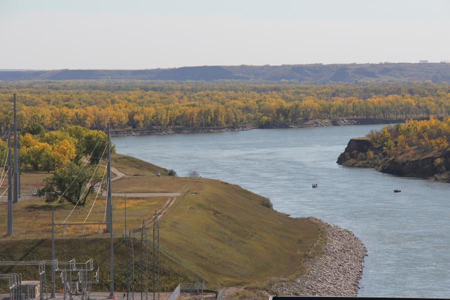
“Landscapes have outstanding memories. Over millions of years sediments have been deposited, removed, and deposited again. We can make this archive accessible layer by layer or section-by-section, decrypting history, and stories that landscapes are recording. … What mainly excites me about landscapes is the invisible, the less obvious, and the hidden. As a landscape architect and environmental designer, I need to observe, explore, and discover.” 1
This field study course takes the students to landscapes and sites at the Missouri River and along the Red River ‘down’ to its origin in North Dakota. It is a journey through space and time reaching far back to the Carboniferous (309 million years ago), exploring the era's role in today’s energy production, carbon emission and landscape rehabilitation projects. We visit the Hidatsa Village at the Knife River and get a glimpse of First Nation people who lived on the Northern Plains on the Upper Missouri in villages while cultivating gardens. The Missouri River has always been an essential lifeline for many living beings. A once free meandering river with interwoven channels, sand bars and expansive alluvial forests has been converted into a sequence of lake-like sections with large dams. The dams were implemented to control flows and floods, create storage, and generate energy with the hope of stimulating the economy. Today, we can study some of the ecological consequences caused by the interventions and explore artificial habitats created through these infrastructure projects. We try to “build up a picture” by acquiring knowledge and information about the rivers and peoples along the waters.
1. Straub, D. (2015). Landschaftslinien: The obvious, the hidden and a method for their decryption. In N. Amoroso (Ed.), Representing Landscapes: Digital (136-143). New York, NY: Routledge.
Instructor: Rick Hiebert
EVIE 4008
Distance Education
July 1 - August 9
3 credit hours
This course focuses on the creation of two-dimensional architectural working drawings in a set of construction documents through the use of advanced features in CAD. Students will learn the concepts of formatting units, text, dimensions, multi-leaders, and layouts, using both non-annotative and annotative scaling techniques. How to use CAD software in a three-dimensional environment to create realistic shapes is also included. May not be held with EVIE 3670.
Instructor: Rick Hiebert
EVIE 4014
Distance Education
July 1 - August 9
3 credit hours
Focus on the concepts of building information modeling (BIM), parametric design, analysis, and construction documentation using current software. Demonstrates effect of this type of software on presentation and construction documentation through the use of intelligent building components and interdependent views of the building model, including acquisition of statistical and other quantitative information.
PR/CR: A minimum grade of C is required unless otherwise indicated.
Pre- or corequisite: EVIE 4008 or consent of instructor.
Instructor: TBD
ARCG 7080
Tuesday/Thursday | 5:30 pm - 8:15 pm
July 1 - August 8
3 credit hours