Erem Rishad
Advisor: Neil Minuk
BENDING THE GRID_Rivers, Oxbows and Alternate Urban Futures in Winnipeg
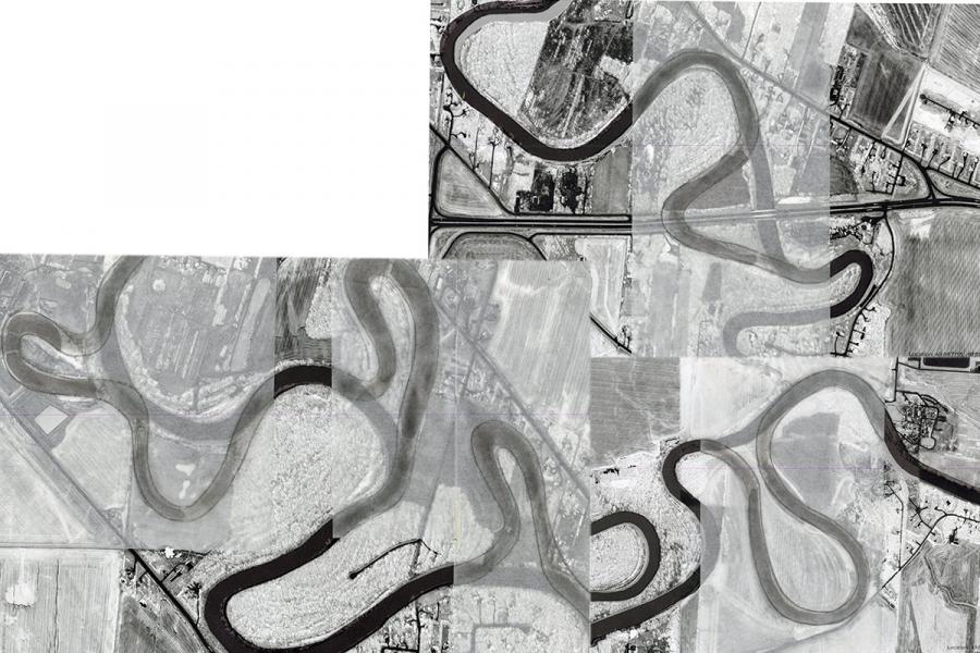
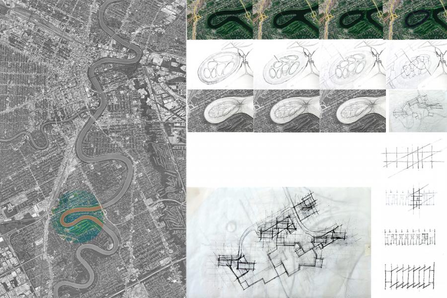
This thesis investigates how the natural geometry of the Red River can inform and transform neighbourhood grid design in Winnipeg. It compares the early French seigneurial system of long, narrow riverfront lots with the later Dominion Land Survey’s rigid square grid, which represent two fundamentally different understandings of land: one responsive to the river and one imposed upon it.
Through the study of historical maps, this research identifies former oxbow lakes along the Red River, including areas near The Forks and Enfield Crescent. Although many of these meanders are no longer visible as open water, their traces remain in the land’s topography, the sitting of buildings, and subtle street slopes, indicating that Winnipeg’s contemporary form continues to be influenced by the river’s earlier paths.
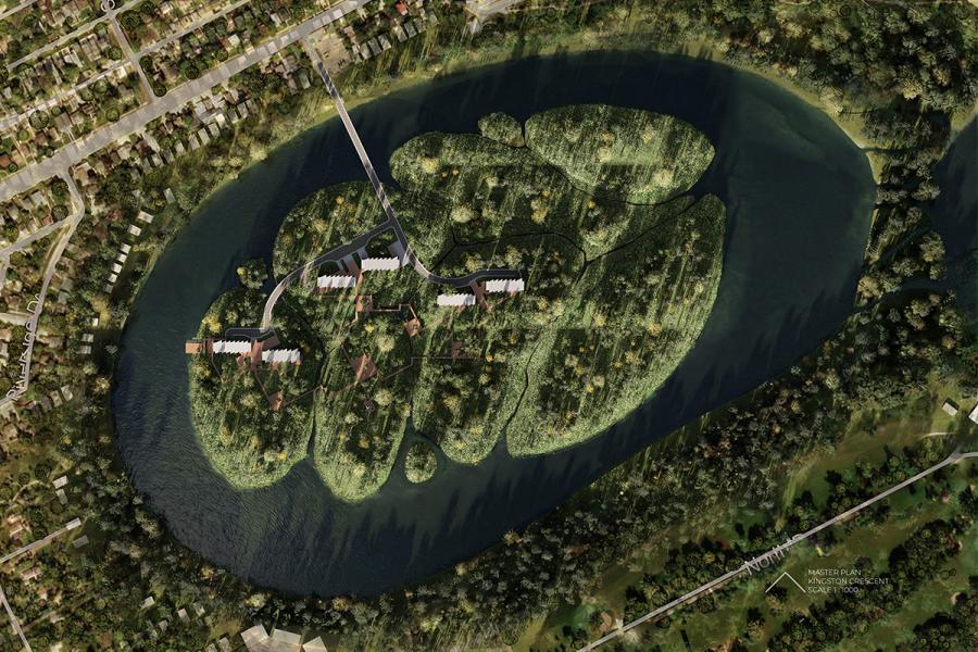
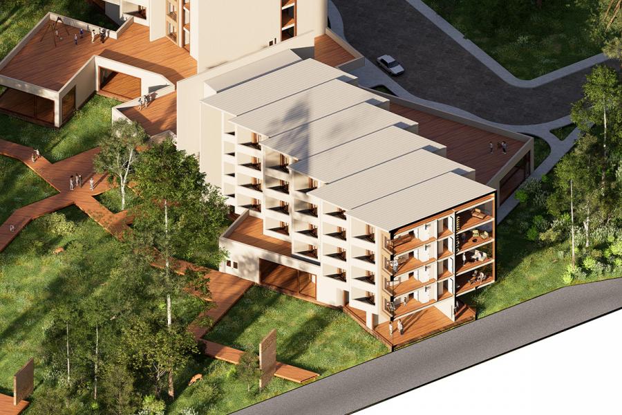
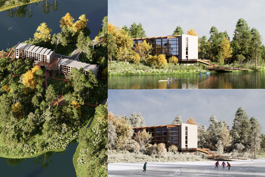
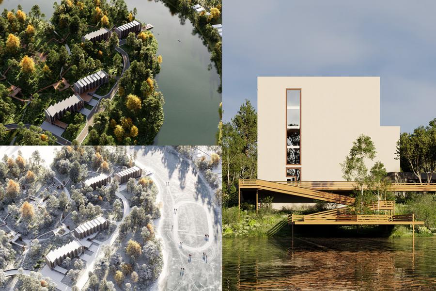
This proposal focuses on Kingston Crescent as a location where the river’s geomorphological history and its potential future transformation intersect. The neighbourhood, defined by a pronounced meander and a documented history of flooding, presents a likely scenario in which the river could eventually cut through and form a new oxbow lake. Through speculative mapping, collage, and layered drawing, the thesis explores how Kingston Crescent might evolve if fluvial processes were allowed to continue, and how human occupation might adapt to, rather than resist, this change.
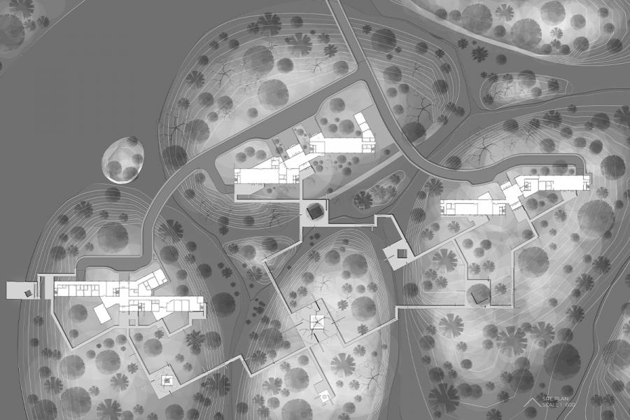
The thesis advances a new type of neighbourhood grid guided by hydrological flow patterns instead of conventional surveying tools. The design incorporates flood-adaptive strategies, including elevated landforms, water channels, and a controlled river–lake gate system, to support a mixed-use residential community rooted in the ecological and historical logic of the river.
Ultimately, this research asks how cities might more accurately reflect the natural systems on which they depend, and how neighbourhoods can be re-imagined through the movements, memory, and future possibilities of the Red River.